|
|
- Cop-eh, Gibbs in Schoolcraft, Ind. Tribes, III, 421, 1853
(mentioned as a dialect).
- Copeh, Latham in Trans. Philolog. Soc., Lond., 79, 1856 (of
Upper Sacramento; cites vocabs. from Gallatin and Schoolcraft).
Latham, Opuscula, 345, 1860. Latham, El. Comp. Phil., 412, 1862.
- Wintoons, Powers in Overland Monthly, 530, June, 1874 (Upper
Sacramento and Upper Trinity). Gatschet in Mag. Am. Hist., 160,
1877 (defines habitat and names tribes). Gatschet in Beach, Ind.
Miscellany, 434, 1877.
- Win-tún, Powell in Cont. N.A. Eth., III, 518-534, 1877
(vocabularies of Wintun, Sacramento River, Trinity Indians).
Gatschet in U.S. Geog. Surv. W. 100th M., VII, 418, 1879
(defines area occupied by family).
- Klamath, Keane, App. to Stanford’s Comp. (Cent. and So.
Am.), 475, 1878 (cited as including Copahs, Patawats, Wintoons).
Bancroft, Nat. Races, III, 565, 1882 (contains Copah).
- Napa, Keane, ibid., 476, 524, 1878 (includes Myacomas,
Calayomanes, Caymus, Ulucas, Suscols). Bancroft, Nat. Races,
III, 567, 1882 (includes Napa, Myacoma, Calayomane, Caymus,
Uluca, Suscol).
This name was proposed by Latham with evident hesitation. He says of
it: “How far this will eventually turn out to be a convenient name
for the group (or how far the group itself will be real), is
uncertain.” Under it he places two vocabularies, one from the Upper
Sacramento and the other from Mag Redings in Shasta County. The head
of Putos Creek is given as headquarters for the language. Recent
investigations have served to fully confirm the validity of the
family.
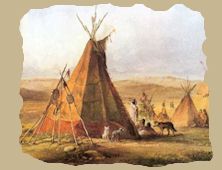
Geographic Distribution
The territory of the Copehan family is bounded on the north by Mount
Shasta and the territory of the Sastean and Lutuamian families, on
the east by the territory of the Palaihnihan, Yanan, and Pujunan
families, and on the south by the bays of San Pablo and Suisun and
the lower waters of the Sacramento.
The eastern boundary of the territory begins about 5 miles east of
Mount Shasta, crosses Pit River a little east of Squaw Creek, and
reaches to within 10 miles of the eastern bank of the Sacramento at
Redding. From Redding to Chico Creek the boundary is about 10 miles
east of the Sacramento. From Chico downward the Pujunan family
encroaches till at the mouth of Feather River it occupies the
eastern bank of the Sacramento. The western boundary of the Copehan
family begins at the northernmost point of San Pablo Bay, trends to
the northwest in a somewhat irregular line till it reaches John’s
Peak, from which point it follows the Coast Range to the tipper
waters of Cottonwood Creek, whence it deflects to the west, crossing
the headwaters of the Trinity and ending at the southern boundary of
the Sastean family.
Principal Tribes
A.
Patwin:
Chenposel.
Gruilito.
Korusi.
Liwaito.
Lolsel.
Makhelchel.
Malaka.
Napa.
Olelato.
Olposel.
Suisun.
Todetabi.
Topaidisel.
Waikosel.
Wailaksel. |
B.
Wintu:
Daupom.
Nomlaki.
Nommuk.
Norelmuk.
Normuk.
Waikenmuk.
Wailaki. |
Indian Linguistic Families of America North of Mexico, 1891
Linguistic
Families
 |