 |
Native American Nations
Your Source for Indian Research Rolls ~ History ~ Treaties ~ Census ~ Books |
|
|
Native American Nations
Your Source for Indian Research Rolls ~ History ~ Treaties ~ Census ~ Books |
|
|
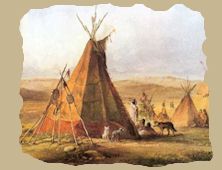
Treaty Concluded October 24, 1804; Proclaimed May 17, 18241
Material Provisions It is agreed and stipulated that:
Historical Data. Congress, under date of February 19, 1799,2 appropriated $25,000 to defray the expense of negotiating a treaty or treaties with the Indians, and again, on the 13th of May, 1800,3 appropriated $15,000 to defray the expense of holding a treaty or treaties with the Indian tribes south-west of the Ohio River, with the proviso that nothing in the act should be construed to admit an obligation on the part of the United States to extinguish for the benefit of any State or individual the Indian claim to any lands lying within the limits of the United States. Pursuant to the authority conferred by these enactments, President Jefferson appointed4 General James Wilkinson, Wm. R. Davie, and Benj. Hawkins as commissioners, and they were instructed by the Secretary of War to proceed to negotiate treaties with the Cherokees, Creeks, Choctaws, and Chickasaws. Objects of the treaty. The objects sought to be attained with the Cherokees were to secure their consent;
If consent was obtained to the first three proposals or to the alternative marked 4th, an annuity of $1,000 was authorized and an immediate sum not exceeding $5,000 in cash or goods. If, as had been represented to the War Department, the Cherokees and Chickasaws both claimed the land on either side of Tennessee River for a considerable distance, the commissioners were instructed that they must obtain the assent of both tribes to the opening of the road. Six days after the issuance of these instructions, a delegation of Cherokees, headed by Chief "Glass," arrived in Washington, and obtained an interview with the Secretary of War.5 They represented that the promise had been made them, at the treaty of 1798, that they would never be asked to cede any more land. Now they learned that the United States was about to hold another treaty with them to secure further cessions. They also desired to know whether the United States or the settlers got the land theretofore ceded, and why they had not been furnished with the map showing the boundary lines by the treaty of 1798, as had been promised them. In his reply,6 after seeing the President, the Secretary of war informed them that no desire existed to purchase any more land from them unless they were anxious to sell; that the map should be at once furnished them; that the States of Kentucky and Tennessee had been formed out of the lands already purchased from them, and the main object of the proposed treaty with their nation was to secure the right of way for roads through their country ill order to maintain communication between detached white settlements. The delegation strenuously objected to the proposed " Georgia" road and were informed that the matter would not be pressed, but that the road to Bear River and Natchez was a necessity. As a result of the visit of this delegation, the instructions to Messrs. Wilkinson, Davie, and Hawkins were modified,6 it being stated by the Secretary of War that he had been mistaken as to part of the line between the United States and the Cherokees. He therefore directed that the second object of their instructions should be suspended as regarded both the Cherokees and the Chickasaws. Commissioner Davie having declined his appointment, General Andrew Pickens was substituted in his stead.7 Failure of negotiations. It is only necessary to observe that the commissioners ailed in the accomplishment of any of their designs with the Cherokees. Watford's Settlement Prior to the survey and marking of the boundary line near Currahee Mountain in Georgia, provided for by the Cherokee treaty of 1785 and the Creek treaty of 1790, which survey did not occur until 1798, one Colonel Wafford, in company with sundry other persons, had formed a settlement in that vicinity, which proved to be within the limits of the Indian country. Inasmuch as it was supposed these parties had ignorantly placed themselves within the Indian line and had made considerable and valuable improvements, the Government was indisposed to use harsh or forcible means for their ejection, but rather approved of the urgent appeals from Colonel Wafford and his neighbors to make an effort to secure the relinquishment from the Indians of a tract sufficient to embrace their settlement. The Government had been laboring under the impression that these lauds belonged to the Creeks, bat the delegation of the Cherokees, headed by " The Glass," who visited Washington in the summer of 1801, claimed them as Cherokee territory, and asked for the removal of the settlers. Commissioners Wilkinson, Hawkins, and Pickens had been instructed8 to negotiate with the Creeks for the purchase of this tract, but they having reported, upon examination, that the title was undoubtedly in the Cherokees, were directed9 to report upon the expediency of applying to the Cherokees for a cession of the same. Such an application having at this time been unfavorably received by the Cherokees, nothing further was done in the matter until the winter of 1803,10 when the Secretary of War directed a conference to be held with them for the double purpose of securing a cession or a lease for seven years of the " Wafford Settlement" tract and the Indian consent to a right of way for a road through their country from Southwest Point or Tellico Factory to Athens, Ga., with the establishment of the necessary houses of entertainment for travelers along such route. For this latter concession he was authorized to offer them the sum of $500. The Cherokees having refused both these propositions, Agent Meigs was directed11 to secure the granting of the road privilege, if possible, by offering Vann' and other men of influence among them a proper inducement to enlist their active cooperation in the matter. This latter method seems to have been effective, for later in the season12 the Secretary of War transmitted to the governors of Georgia and Tennessee an extract from an agreement entered into with the Cherokees providing for an opening of the desired road, stating that, as the United States had no funds applicable to the laying out and construction of such a road, it would be proper for the legislatures of those States to make the necessary provision there for. The clamor for more land by the constant tide of immigration that was flowing into Kentucky, Tennessee, and Georgia from the North and East became more and. more importunate. The desire to settle on Indian land was as potent and insatiable with the average border settler then as it is now. Further Negotiations Authorized Notwithstanding the recent and oft-repeated refusals of the Cherokees to part with more land, a new commission, consisting of Return J. Meigs and Daniel Smith, was appointed and instructed13 by the Secretary of War to negotiate a treaty for the cession of lands in Kentucky, Tennessee, or Georgia, and particularly of the tract near the Currahee Mountain, including the Wafford settlement. They were authorized to pay for the first cession a sum not exceeding $14,000, coupled with an annuity of $3,000, and for the "Wafford tract" not exceeding $5,000, together with an annuity of 81,000, and were directed to give "Vann," a Cherokee chief, $200 or $300 to secure his influence in favor of the proposed purchase. Purchase of Wafford settlement tract. In pursuance of these instructions a conference was held with the Cherokees at Tellico, Tenn.,14 at which they concluded the arrangements for the cession of the Wafford tract, but failed in their further objects. The treaty was signed on the 24th of October, and transmitted to the Secretary of War a week later,15 two persons hag been appointed to designate and run the lines of the ceded tract, which was found to be 23 miles and 64 chains in length and 4 miles in width.16 Singular disappearance of treaty. No action having been taken looking toward the ratification of this treaty for several years ensuing, Return J. Meigs, in the winter of 1811,17 addressed a letter to the Secretary of War calling attention to it, setting forth the fact that its consideration had theretofore been postponed on account of a misunderstanding in relation to the limits of the ceded tract, but that the Cherokees had now of their own motion, and at their own expense, had a survey made of 10 miles and 12 chains in length in addition to the original survey, which would make the tract ceded 33 miles and 76 chains in length, and which would include the plantation of every settler who could make the shadow of a claim to settlement prior to the survey of the general boundary line run in 179718 by Colonel Hawkins. He there-fore concluded that there could be no reason for farther postponing the ratification of the treaty, and urged that it be done without delay. Notwithstanding this letter of Agent Meigs no further notice seems to have been taken of the treaty, and it had been entirely lost sight of until attention was again called to it by a Cherokee delegation visiting Washington early in 1824, nearly twenty years after its conclusion.19 After diligent search among the records of the War Department, Secretary Calhoun reported20 that no such treaty could be found and no evidence that any such treaty had ever been concluded. Whereupon the Cherokee delegation produced their duplicate copy of the treaty together with other papers relating to it. The Secretary of War, after receiving a reply21 to a letter addressed by him to Colonel McKee, of the House of Representatives (who was one of the subscribing witnesses to the treaty), became satisfied of its authenticity, and the President thereupon22 transmitted the Cherokee duplicate to the Senate, which body advised and consented to its ratification. It was duly proclaimed by the President on the 17th of May, 1824.23 1 United States Statutes at Large, Vol. VII, p.
228. This site includes some historical materials that may imply negative stereotypes reflecting the culture or language of a particular period or place. These items are presented as part of the historical record and should not be interpreted to mean that the WebMasters in any way endorse the stereotypes implied. Bureau of Ethnology, Volume 5, Cherokee Nation of Indians, 1883-84
|
|
|
|
Copyright 2000-2019 by NaNations.com and/or their author(s). The webpages may be linked to but shall not be reproduced on another site without written permission from NaNations or their author. Images may not be linked to in any manner or method. Anyone may use the information provided here freely for personal use only. If you plan on publishing your personal information to the web please give proper credit to our site for providing this information. Thanks!!! |